← Back to Harborough District Council

Status

Pending Consideration New housing
Received 12 Nov 2025
New dwellings 180

What you can do

Take Action

Make your voice heard. Authorities need to hear from people who support new homes.

Summary

Erection of up to 180 residential units with amenities.

Full Proposal

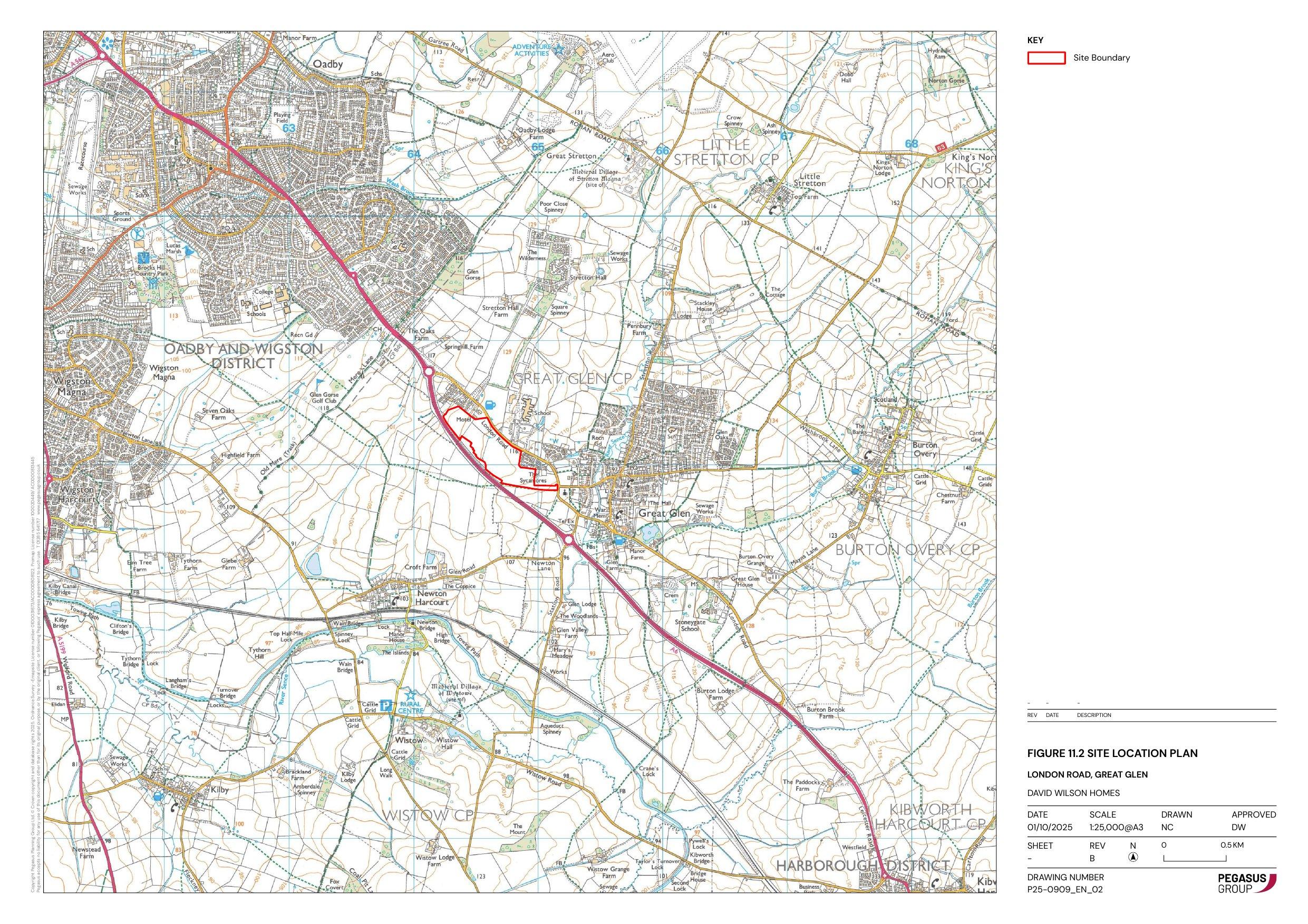
Outline planning application for the erection of up to 180 dwellings including open space, play space, land for allotments, car parking, drainage, utilities connections, and the construction of a new access off London Road (access only to be considered)

Reasonable Objection Grounds

These are planning grounds where objections may be reasonable for this application:

Traffic Scale Amenity

Likely Support Reasons

These are potential reasons to support this application based on the proposal:

Housing Need Brownfield Density

Detail pages

Documents

ACCESS AND MOVEMENT PLAN
Proposed Plan
Not downloaded · Council link
AIR QUALITY ASSESSMENT
Supporting Information
Not downloaded · Council link
APPLICATION FORM - WITHOUT PERSONAL DATA
Application Form
Not downloaded · Council link
ARBORICULTURAL ASSESSMENT
Supporting Information
Not downloaded · Council link
BIODIVERSITY NET GAIN REPORT
Ecology Survey
Not downloaded · Council link
BNG STATUTORY METRIC CALCULATION TOOL
Ecology Survey
Not downloaded · Council link
BUILDINGS HEIGHT PARAMETER PLAN
Proposed Plan
Not downloaded · Council link
COVERING LETTER
Correspondence
Not downloaded · Council link
Design & Access Statement
Not downloaded · Council link
ECOLOGICAL IMPACT ASSESSMENT
Ecology Survey
Not downloaded · Council link
ENERGY AND SUSTAINABILITY STATEMENT
Supporting Information
Not downloaded · Council link
ES APPENDIX 1.1 ASSESSOR INFORMATION
Supporting Information
Not downloaded · Council link
ES APPENDIX 1.2 GLOSSARY OF TERMS
Supporting Information
Not downloaded · Council link
ES APPENDIX 10.1 FLOOD RISK ASSESSMENT
Supporting Information
Not downloaded · Council link
ES APPENDIX 11.1 LVIA METHODOLOGY
Supporting Information
Not downloaded · Council link
ES APPENDIX 11.2 EXTRACTS FROM PUBLISHED LANDSCAPE CHARACTER ASSESSMENTS
Supporting Information
Not downloaded · Council link
ES APPENDIX 12.1 SUMMARY OF EFFECTS
Supporting Information
Not downloaded · Council link
ES APPENDIX 12.2 SUMMARY OF MITIGATION MEASURES
Supporting Information
Not downloaded · Council link
ES APPENDIX 3.1 ARBORICULTURAL ASSESSMENT
Supporting Information
Not downloaded · Council link
ES APPENDIX 3.2 ENERGY AND SUSTAINABILITY STATEMENT
Supporting Information
Not downloaded · Council link
ES APPENDIX 7.1 TRANSPORT ASSESSMENT
Supporting Information
Not downloaded · Council link
ES APPENDIX 7.3 SCOPING RESPONSES HIGHWAYS CORRESPONDENCE
Supporting Information
Not downloaded · Council link
ES APPENDIX 7.4 PROPOSED SITE ACCESS
Supporting Information
Not downloaded · Council link
ES APPENDIX 8.1 AIR QUALITY ASSESSMENT.
Supporting Information
Not downloaded · Council link
ES APPENDIX 9.1 HISTORIC ENVIRONMENT DESK BASED ASSESSMENT
Supporting Information
Not downloaded · Council link
ES FIGURE 11.1 SCREENED ZONE OF THEORETICAL VISIBILITY
Supporting Information
Not downloaded · Council link
ES FIGURE 11.2 SITE LOCATION PLAN
Supporting Information
Archived copy · Council link
ES FIGURE 11.3 ENVIRONMENTAL DESIGNATIONS PLAN
Supporting Information
Not downloaded · Council link
ES FIGURE 11.4 LANDSCAPE CHARACTER PLAN
Supporting Information
Not downloaded · Council link
ES FIGURE 11.5 VIEWPOINT LOCATION PLAN
Supporting Information
Not downloaded · Council link
ES FIGURE 11.6 VIEWPOINTS 1 TO 18 ANNOTATED PHOTOGRAPHS-1
Supporting Information
Not downloaded · Council link
ES FIGURE 11.6 VIEWPOINTS 1 TO 18 ANNOTATED PHOTOGRAPHS-10
Supporting Information
Not downloaded · Council link
ES FIGURE 11.6 VIEWPOINTS 1 TO 18 ANNOTATED PHOTOGRAPHS-11
Supporting Information
Not downloaded · Council link
ES FIGURE 11.6 VIEWPOINTS 1 TO 18 ANNOTATED PHOTOGRAPHS-12
Supporting Information
Not downloaded · Council link
ES FIGURE 11.6 VIEWPOINTS 1 TO 18 ANNOTATED PHOTOGRAPHS-13
Supporting Information
Not downloaded · Council link
ES FIGURE 11.6 VIEWPOINTS 1 TO 18 ANNOTATED PHOTOGRAPHS-14
Supporting Information
Not downloaded · Council link
ES FIGURE 11.6 VIEWPOINTS 1 TO 18 ANNOTATED PHOTOGRAPHS-15
Supporting Information
Not downloaded · Council link
ES FIGURE 11.6 VIEWPOINTS 1 TO 18 ANNOTATED PHOTOGRAPHS-16
Supporting Information
Not downloaded · Council link
ES FIGURE 11.6 VIEWPOINTS 1 TO 18 ANNOTATED PHOTOGRAPHS-17
Supporting Information
Not downloaded · Council link
ES FIGURE 11.6 VIEWPOINTS 1 TO 18 ANNOTATED PHOTOGRAPHS-18
Supporting Information
Not downloaded · Council link
ES FIGURE 11.6 VIEWPOINTS 1 TO 18 ANNOTATED PHOTOGRAPHS-2
Supporting Information
Not downloaded · Council link
ES FIGURE 11.6 VIEWPOINTS 1 TO 18 ANNOTATED PHOTOGRAPHS-3
Supporting Information
Not downloaded · Council link
ES FIGURE 11.6 VIEWPOINTS 1 TO 18 ANNOTATED PHOTOGRAPHS-4
Supporting Information
Not downloaded · Council link
ES FIGURE 11.6 VIEWPOINTS 1 TO 18 ANNOTATED PHOTOGRAPHS-5A
Supporting Information
Not downloaded · Council link
ES FIGURE 11.6 VIEWPOINTS 1 TO 18 ANNOTATED PHOTOGRAPHS-5B
Supporting Information
Not downloaded · Council link
ES FIGURE 11.6 VIEWPOINTS 1 TO 18 ANNOTATED PHOTOGRAPHS-6
Supporting Information
Not downloaded · Council link
ES FIGURE 11.6 VIEWPOINTS 1 TO 18 ANNOTATED PHOTOGRAPHS-7
Supporting Information
Not downloaded · Council link
ES FIGURE 11.6 VIEWPOINTS 1 TO 18 ANNOTATED PHOTOGRAPHS-8
Supporting Information
Not downloaded · Council link
ES FIGURE 11.6 VIEWPOINTS 1 TO 18 ANNOTATED PHOTOGRAPHS-9
Supporting Information
Not downloaded · Council link
ES FIGURE 11.7 VIEWS A-O PHOTOGRAPHS FROM SITE INTERIOR-1-2
Supporting Information
Not downloaded · Council link
ES FIGURE 11.7 VIEWS A-O PHOTOGRAPHS FROM SITE INTERIOR-3-5
Supporting Information
Not downloaded · Council link
ES FIGURE 11.8 VIEWS A-O LOCATION PLAN
Supporting Information
Not downloaded · Council link
ES FIGURE 3.1 LAND USE PARAMETER PLAN
Supporting Information
Not downloaded · Council link
ES FIGURE 3.2 BUILDING HEIGHTS PARAMETER PLAN
Supporting Information
Not downloaded · Council link
ES FIGURE 3.3 GREEN AND BLUE INFRASTRUCTURE
Supporting Information
Not downloaded · Council link
ES FIGURE 3.4 ACCESS AND MOVEMENT PLAN
Supporting Information
Not downloaded · Council link
ES FIGURE 3.5 ILLUSTRATIVE MASTERPLAN
Supporting Information
Not downloaded · Council link
ES FIGURE 3.6 PROPOSED SITE ACCESS
Supporting Information
Not downloaded · Council link
ES FIGURE 8.1 CONSTRUCTION PHASE RECEPTORS
Supporting Information
Not downloaded · Council link
ES FIGURE 8.2 SENSITIVE HUMAN RECEPTORS
Supporting Information
Not downloaded · Council link
ES FIGURE 8.3 LOCAL MONITORING
Supporting Information
Not downloaded · Council link
ES FIGURE 8.4 ANNUAL MEAN NO2 CONTOUR
Supporting Information
Not downloaded · Council link
ES FIGURE 8.5 ANNUAL MEAN PM10 CONTOUR
Supporting Information
Not downloaded · Council link
ES FIGURE 8.6 ANNUAL MEAN PM2.5 CONTOUR
Supporting Information
Not downloaded · Council link
ES FIGURE 9.1 SITE LOCATION
Supporting Information
Not downloaded · Council link
ES FIGURE 9.1 SITE LOCATION
Supporting Information
Not downloaded · Council link
ES FIGURE 9.2 DESIGNATED HERITAGE ASSETS
Supporting Information
Not downloaded · Council link
ES FIGURE 9.3 MONUMENTS
Supporting Information
Not downloaded · Council link
ES FIGURE 9.4 EVENTS
Supporting Information
Not downloaded · Council link
ES FIGURE 9.5 LIDAR
Supporting Information
Not downloaded · Council link
ES NON TECHNICAL SUMMARY
Supporting Information
Not downloaded · Council link
ES VOLUME 1 - MAIN STATEMENT
Supporting Information
Not downloaded · Council link
Flood Risk Assessment
Not downloaded · Council link
GREEN AND BLUE INFRASTRUCTURE PLAN
Proposed Plan
Not downloaded · Council link
HDC ENVIRONMENT COORDINATOR
Consultation Response
Not downloaded · Council link
HDC ENVIRONMENTAL SERVICES
Consultation Response
Not downloaded · Council link
HEALTH IMPACT ASSESSMENT
Supporting Information
Not downloaded · Council link
HISTORIC ENVIRONMENT DESK-BASED ASSESSMENT
Supporting Information
Not downloaded · Council link
ILLUSTRATIVE MASTERPLAN
Proposed Plan
Not downloaded · Council link
LAND USE PLAN
Proposed Plan
Not downloaded · Council link
LANDSCAPE AND VISUAL IMPACT ASSESSMENT
Supporting Information
Not downloaded · Council link
LANDSCAPE MASTERPLAN
Proposed Plan
Not downloaded · Council link
LCC HIGHWAYS ADVICE
Supporting Information
Not downloaded · Council link
LEICESTERSHIRE FIRE & RESCUE
Consultation Response
Not downloaded · Council link
NOISE IMPACT ASSESSMENT
Supporting Information
Not downloaded · Council link
PLANNING STATEMENT
Supporting Information
Not downloaded · Council link
RESIDENTIAL TRAVEL PLAN
Supporting Information
Not downloaded · Council link
Site Location
Site Location
Not downloaded · Council link
SOCIOECONOMIC STATEMENT
Supporting Information
Not downloaded · Council link
STATEMENT OF COMMUNITY INVOLVEMENT
Supporting Information
Not downloaded · Council link
TOPOGRAPHICAL SURVEY
Existing Plans
Not downloaded · Council link
TRANSPORT ASSESSMENT
Highways Report
Not downloaded · Council link
TRAVEL PLAN
Supporting Information
Not downloaded · Council link
UTILITIES ASSESSMENT
Supporting Information
Not downloaded · Council link